bdf surveys
  • 0773408288601242 461757
    info@bdfsurveys.com

    Topographic Land Surveys in Cheltenham & The Cotswolds

    REQUEST A QUOTE

We provide detailed topographic land surveys across Cheltenham, The Cotswolds, Gloucestershire, Oxfordshire and Warwickshire. A topographic survey delivers a precise, mapped record of natural and man-made features within a defined area, supporting planning applications, architectural design, development and site assessment.


By accurately recording existing site conditions - including levels, buildings, boundaries, highways, trees and utilities - our surveys provide the reliable ground data required to identify constraints and enable informed design decisions. Whether you are a homeowner, architect, developer or contractor, we supply clear, dependable survey information tailored to your project.

Accurate Measured surveys

What is a Topographic Land Survey?

A topographic land survey provides a precise, mapped record of natural and man-made features within a defined area. It reveals existing conditions and potential obstacles, helping designers and planners create appropriate, site-specific solutions.
Experienced Surveyors

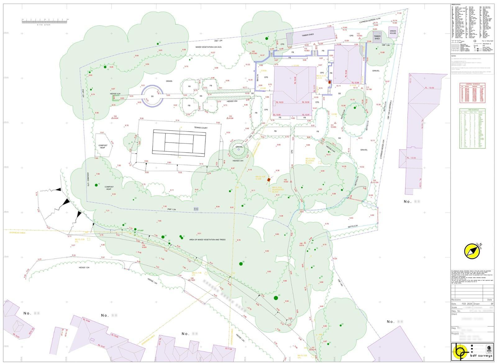
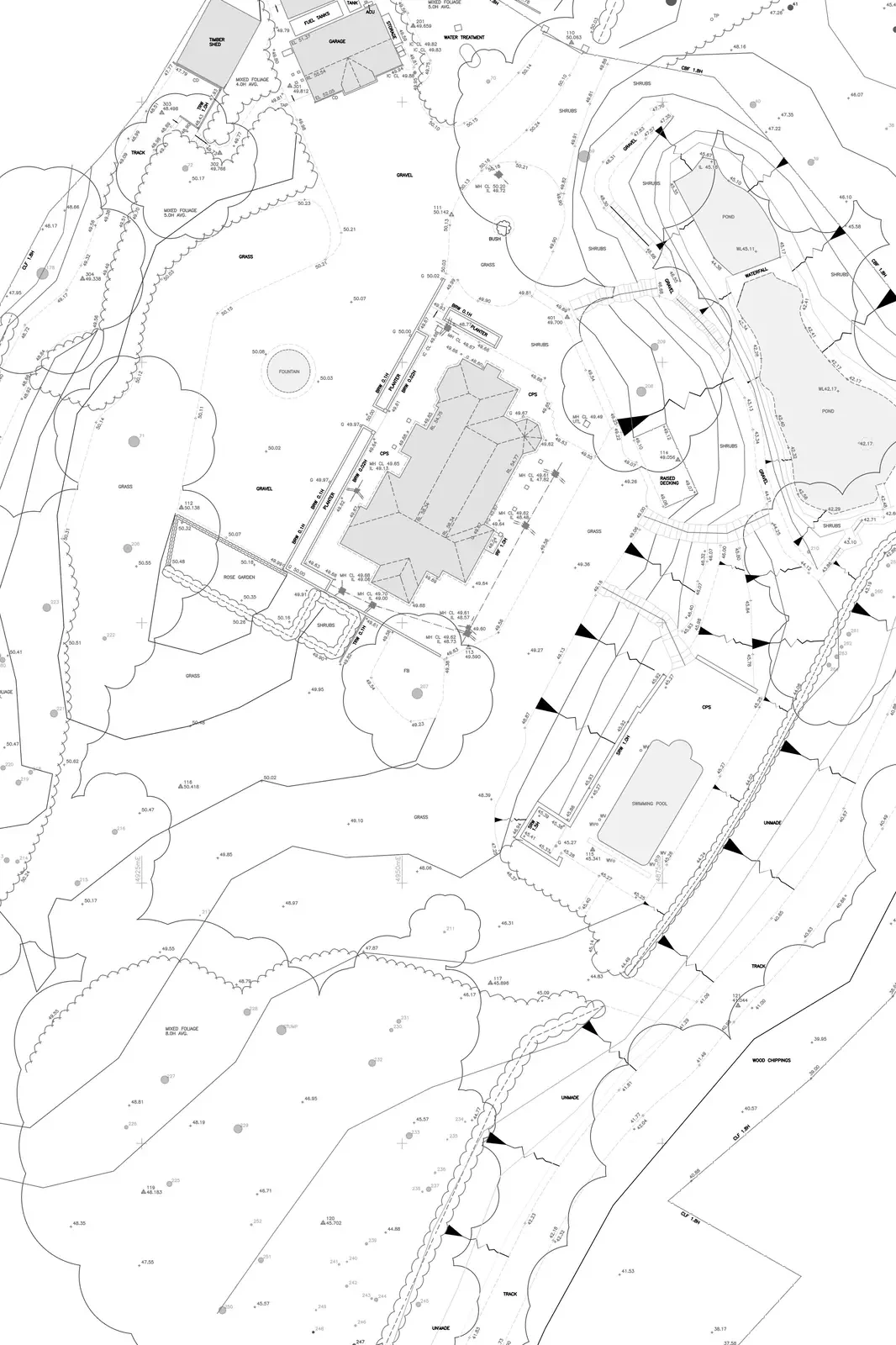
What our Topographic Surveys include

  • Buildings and structures

  • Site levels and contours

  • Highways & hardstanding

  • Boundaries and fencing

  • Trees and vegetation

  • Drainage and utilities

  • Service covers and inspection chambers


Every survey is delivered with clarity, making complex data easy to interpret and apply.

Timely and Prompt Survey services

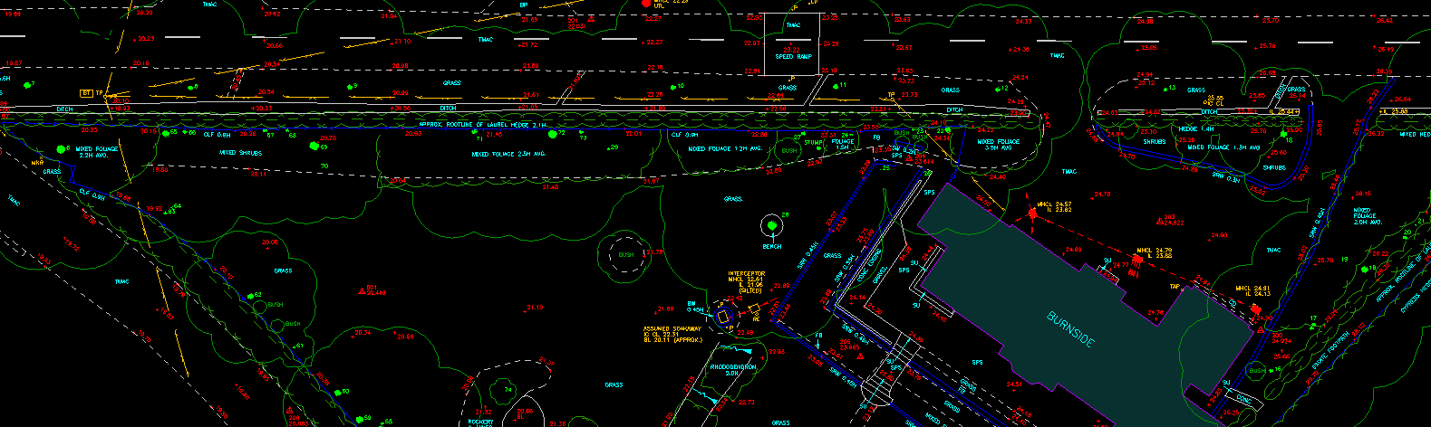
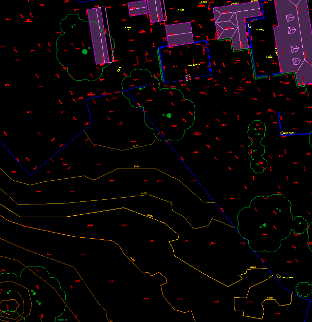
Technology & Equipment


Using Total Stations, terrestrial laser scanners and GPS - combined with fundamental surveying principles - we deliver highly accurate data to support your project. Our equipment enables the capture of fine detail and ensures reliable results you can depend on.
Bespoke Survey Services

Bespoke Surveys to Suit Your Project

We tailor every topographic survey to your scope, objectives and budget. Whether you require a full site plan, level data, area measurements or a Digital Terrain Model (DTM), BDF Surveys provides clear, precise outputs to support confident decision-making.

How a Topographic Survey Supports Your Project

A professional topographic land survey provides a clear and accurate understanding of your site before design or construction begins. By recording existing levels, boundaries, structures and constraints, it ensures that proposals are based on reliable data rather than assumption.


For residential projects, this means extensions, new builds and alterations can be designed to respond correctly to levels, neighbouring properties and drainage requirements. For commercial and development schemes, detailed survey information supports planning strategy, access design, feasibility assessments and cost planning.


Accurate site data reduces risk, prevents costly redesign and enables coordination between architects, engineers and contractors from the earliest stages. Whether your project is small in scale or part of a wider development strategy, a comprehensive topographic survey provides the foundation for informed decision-making.

Get in touch to start your Project with confidence

Residential & Commercial Development

Accurate topographic surveys provide the detailed site information required for layout planning, access design, drainage strategy and level coordination — helping ensure proposals are practical, policy-compliant and commercially viable.

Planning & Architectural Design

Architects and planning consultants rely on precise survey data to develop proposals that respond appropriately to existing levels, neighbouring properties and surrounding constraints.

Conservation Sites

For sensitive or historic locations, detailed topographic surveys record surrounding landformS and context, supporting informed preservation, restoration and enhancement strategies.

Landscape Design

Reliable topographic data enables landscape architects to respond effectively to natural gradients, vegetation and drainage patterns, ensuring designs work harmoniously with site conditions.

Digital Terrain Models

A Digital Terrain Model (DTM) provides a precise three-dimensional representation of the ground surface, capturing variations in level across a site. Derived from detailed topographic survey data, it models the natural terrain and enables accurate analysis of gradients, drainage and earthworks requirements.


For planning and development proposals, DTMs supply clear level data to support layout design and site feasibility assessments. They help developers and consultants present informed schemes to local planning authorities, ensuring proposals respond appropriately to site constraints from the outset.

Area & Volume Calculations

Accurate site area calculations provide precise measurements of land parcels, supporting planning applications, development layouts and legal boundary requirements. Whether confirming total site area or subdividing plots, reliable measurements are essential for informed decision-making.


We also provide volumetric calculations where required, assisting with cut-and-fill analysis, earthworks planning and material estimation. Precise area and volume data supports cost planning, feasibility assessments and effective resource management across residential and commercial projects.

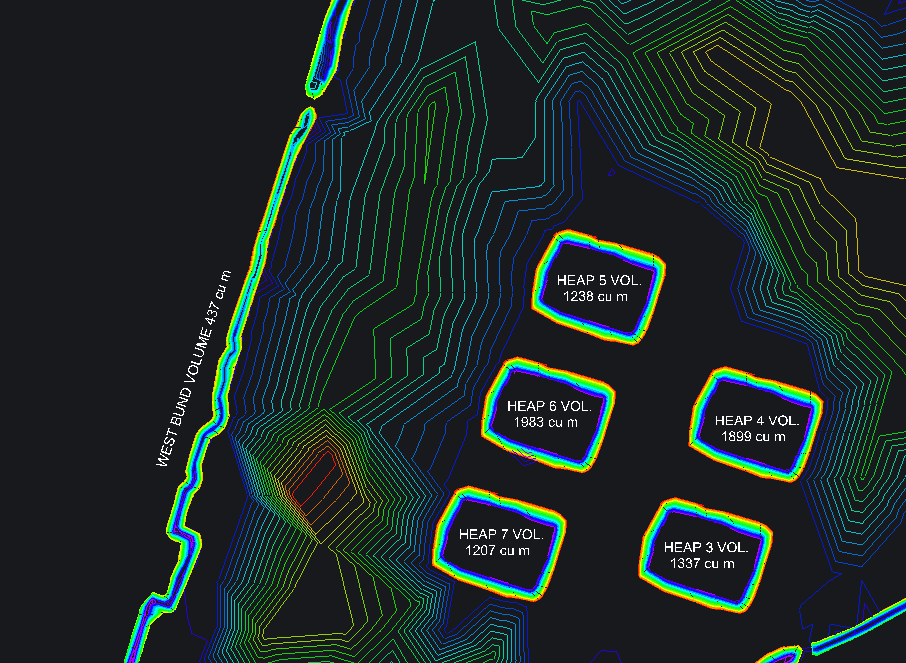
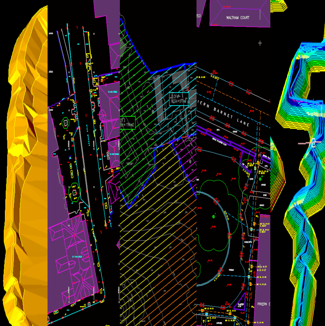
Example Topographic Survey Output

Our survey drawings are supplied in clear, CAD-compatible formats, including detailed level data, boundaries, features and annotations to support planning and design teams.